
Bueras topographic map
Click on the map to display elevation.
About this map
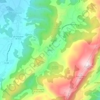
Name: Bueras topographic map, elevation, terrain.
Location: Bueras, Voto, Cantabria, 39766, Spain (43.31992 -3.49892 43.35992 -3.45892)
Average elevation: 719 ft
Minimum elevation: 52 ft
Maximum elevation: 1,759 ft