
Thank you for supporting this site ❤️
Make a donation
Make a donation
Gear up for your next adventure:
As an Amazon Associate, this site earns from qualifying purchases at no extra cost to you.
Phu My topographic map
Click on the map to display elevation.
Thank you for supporting this site ❤️
Make a donation
Make a donation
Gear up for your next adventure:
As an Amazon Associate, this site earns from qualifying purchases at no extra cost to you.
About this map
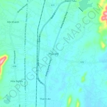
Name: Phu My topographic map, elevation, terrain.
Location: Phu My, Phù Mỹ District, Bình Định Province, Vietnam (14.13523 109.01230 14.21523 109.09230)
Average elevation: 118 ft
Minimum elevation: 33 ft
Maximum elevation: 817 ft
Thank you for supporting this site ❤️
Make a donation
Make a donation
Gear up for your next adventure:
As an Amazon Associate, this site earns from qualifying purchases at no extra cost to you.