Geolocate

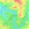
Higgins topographic map

Click on the map to display elevation.

About this map

Name: Higgins topographic map, elevation, terrain.

Location: Higgins, District of Belconnen, Australian Capital Territory, Australia (-35.24199 149.01675 -35.22441 149.03501)

Average elevation: 1,962 ft

Minimum elevation: 1,844 ft

Maximum elevation: 2,133 ft

Other topographic maps

Click on a map to view its topography, its elevation and its terrain.
Diddams Close Park

Australia > District of Belconnen

Average elevation: 1,932 ft

Ginninderra Creek

Australia > District of Belconnen

Average elevation: 1,929 ft

Gossan Hill

Australia > District of Belconnen

Average elevation: 2,041 ft

Mount Rogers

Australia > District of Belconnen

Mount Rogers is a large hill, with an elevation of 704 metres (2,310 ft), located in the northern suburbs of Canberra, within the Australian Capital Territory, Australia. There is a park called the Mount Rogers Reserve at the crest of the hill, and a trig point at the summit.

Average elevation: 2,034 ft

Gear up for your next adventure:

🧯Emergency Survival Kit - All‑in‑one survival essentials for the backcountry
🧥Waterproof Jacket for Hiking - Breathable and rugged rain jacket for outdoor excursions
🧣Hiking Neck Gaiter - Multi‑use neck protection for outdoor weather
💧Water Filtration Bottles - Safely drink from streams and lakes while exploring
🪶Camping Sleeping Pad - Comfortable sleeping pad for backpacking

As an Amazon Associate, this site earns from qualifying purchases at no extra cost to you.