
Thank you for supporting this site ❤️
Make a donation
Make a donation
Gear up for your next adventure:
As an Amazon Associate, this site earns from qualifying purchases at no extra cost to you.
Montetoni topographic map
Click on the map to display elevation.
Thank you for supporting this site ❤️
Make a donation
Make a donation
Gear up for your next adventure:
As an Amazon Associate, this site earns from qualifying purchases at no extra cost to you.
About this map
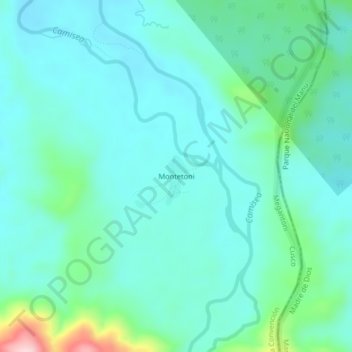
Name: Montetoni topographic map, elevation, terrain.
Location: Montetoni, Megantoni, La Convención, Cusco, Peru (-11.91297 -72.37922 -11.87297 -72.33922)
Average elevation: 1,791 ft
Minimum elevation: 1,634 ft
Maximum elevation: 2,493 ft
Thank you for supporting this site ❤️
Make a donation
Make a donation
Gear up for your next adventure:
As an Amazon Associate, this site earns from qualifying purchases at no extra cost to you.