
Thank you for supporting this site ❤️
Make a donation
Make a donation
Gear up for your next adventure:
As an Amazon Associate, this site earns from qualifying purchases at no extra cost to you.
Talawi topographic map
Click on the map to display elevation.
Thank you for supporting this site ❤️
Make a donation
Make a donation
Gear up for your next adventure:
As an Amazon Associate, this site earns from qualifying purchases at no extra cost to you.
About this map
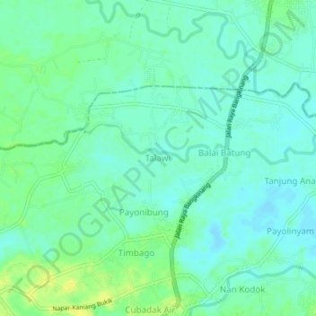
Name: Talawi topographic map, elevation, terrain.
Location: Talawi, Payakumbuh, West Sumatra, Sumatra, Indonesia (-0.21573 100.62336 -0.17573 100.66336)
Average elevation: 1,644 ft
Minimum elevation: 1,617 ft
Maximum elevation: 1,686 ft
Thank you for supporting this site ❤️
Make a donation
Make a donation
Gear up for your next adventure:
As an Amazon Associate, this site earns from qualifying purchases at no extra cost to you.