Geolocate

Salceda topographic map

Click on the map to display elevation.

About this map

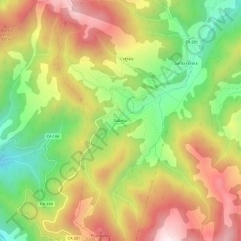
Name: Salceda topographic map, elevation, terrain.

Location: Salceda, Polaciones, Cantabria, 39557, Spain (43.05997 -4.47830 43.09997 -4.43830)

Average elevation: 3,757 ft

Minimum elevation: 2,602 ft

Maximum elevation: 4,951 ft

Gear up for your next adventure:

🥄Camping Utensil Set - Lightweight utensils for outdoor meals
📡Handheld GPS Device - Reliable handheld GPS for outdoor navigation
🔦Powerful Headlamps - Ultra-bright hands-free lighting for night navigation
🦟Ultrasonic Repellers - Create a bug-free zone at your camp or rest stop
🌡️Handheld Weather Meters - Measure wind, temp, and pressure for safe mountain travel

As an Amazon Associate, this site earns from qualifying purchases at no extra cost to you.