Geolocate

Amarkantak topographic map

Click on the map to display elevation.

Amarkantak

Amarkantak is located in Madhya Pradesh in India at 22°40′N 81°45′E / 22.67°N 81.75°E / 22.67; 81.75. It has an average elevation of 1,048 m (3,438 ft). Roads running through Rewa, Shahdol, Anuppur, Jabalpur, Katni, Bilaspur and Gaurella connect it. The nearest railway stations are Pendra Road and Anuppur. The nearest airport is Bilaspur Airport (120 km).

Wikipedia (CC-BY-SA 3.0)

About this map

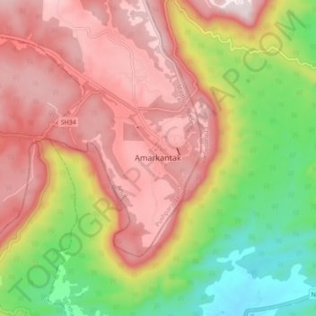
Name: Amarkantak topographic map, elevation, terrain.

Location: Amarkantak, Pushparajgarh Tehsil, Anuppur, Madhya Pradesh, 484886, India (22.63047 81.71884 22.71047 81.79884)

Average elevation: 2,900 ft

Minimum elevation: 1,903 ft

Maximum elevation: 3,711 ft

Gear up for your next adventure:

🚪Portable Camp Chair - Foldable chair for comfort at camp
🕶️Glacier Sunglasses - Side shields to protect eyes from high-altitude snow glare
🥾Women's Hiking Boots - Top-rated trail boots with ankle support and superior grip
📱Heavy-Duty Phone Cases - Drop-proof and waterproof protection for outdoor navigation
🔭Stargazing Telescopes - Perfect for camping in low-light pollution areas shown on maps

As an Amazon Associate, this site earns from qualifying purchases at no extra cost to you.