Geolocate

Tindal topographic map

Click on the map to display elevation.

About this map

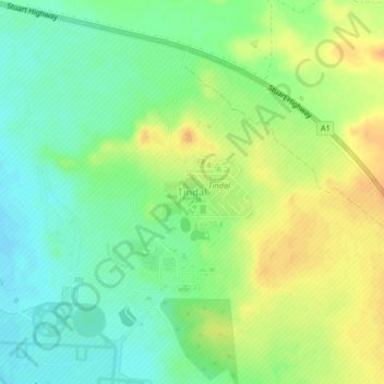
Name: Tindal topographic map, elevation, terrain.

Location: Tindal, Town of Katherine, Northern Territory, Australia (-14.51865 132.37693 -14.47865 132.41693)

Average elevation: 482 ft

Minimum elevation: 430 ft

Maximum elevation: 538 ft

Other topographic maps

Click on a map to view its topography, its elevation and its terrain.

Katherine

Australia > Town of Katherine

Average elevation: 348 ft

Katherine

Australia > Town of Katherine

Average elevation: 348 ft

Venn

Australia > Town of Katherine

Average elevation: 630 ft

Manbulloo

Australia > Town of Katherine

Average elevation: 535 ft

Katherine

Australia > Town of Katherine

Average elevation: 348 ft

Gear up for your next adventure:

🧭Outdoor Navigation Book - Learn advanced navigation skills
📦Gear Storage Bags - Organize and protect outdoor equipment
🥤Water Filter Bottle - All‑in‑one filter bottle for safe hydration
🔋Solar Power Banks - Keep your GPS and phone charged in remote wilderness areas
🧦Merino Wool Socks - Moisture-wicking, blister-preventing socks for long treks

As an Amazon Associate, this site earns from qualifying purchases at no extra cost to you.