Geolocate

Compreng topographic map

Click on the map to display elevation.

About this map

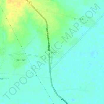
Name: Compreng topographic map, elevation, terrain.

Location: Compreng, Widang, Tuban, East Java, Java, 62383, Indonesia (-7.04871 112.12639 -7.00871 112.16639)

Average elevation: 39 ft

Minimum elevation: 13 ft

Maximum elevation: 102 ft

Gear up for your next adventure:

🪶Wildlife Field Guides - Learn animal tracking and species ID
👖Convertible Hiking Pants - Versatile zip-off pants for changing altitudes and temperatures
🧭Outdoor Navigation Book - Learn advanced navigation skills
🎒Waterproof Dry Bags - Keep your electronics and maps dry inside your pack
🧭Hiking Compass - Precision compass for reliable navigation in the wilderness

As an Amazon Associate, this site earns from qualifying purchases at no extra cost to you.