Geolocate

Kalagala topographic map

Click on the map to display elevation.

About this map

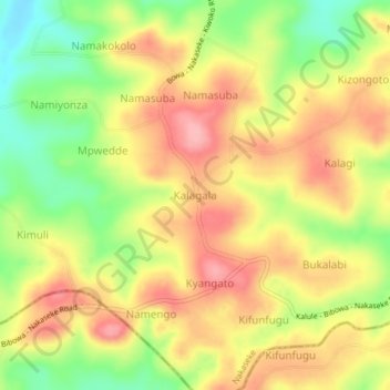
Name: Kalagala topographic map, elevation, terrain.

Location: Kalagala, Nakaseke, Central Region, Uganda (0.65946 32.40628 0.69946 32.44628)

Average elevation: 4,022 ft

Minimum elevation: 3,786 ft

Maximum elevation: 4,216 ft

Gear up for your next adventure:

🗺️NatGeo Topo Maps - High-quality waterproof printed topographic maps of US Parks
🧦Merino Wool Socks - Moisture-wicking, blister-preventing socks for long treks
🧢Outdoor Hiking Hat - Sun protection hat for outdoor explorers
🖼️Topo Map Wall Art - Decorative topographic prints of famous peaks and regions
🌡️Portable Weather Meter - Track weather conditions on the trail

As an Amazon Associate, this site earns from qualifying purchases at no extra cost to you.