Geolocate

Gallotto topographic map

Click on the map to display elevation.

About this map

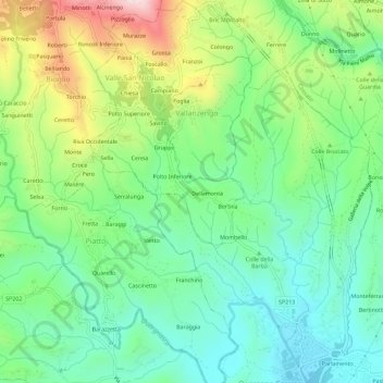
Name: Gallotto topographic map, elevation, terrain.

Location: Gallotto, Valle San Nicolao, Biella, Piemonte, 13847, Italia (45.57502 8.12971 45.61502 8.16971)

Average elevation: 1,237 ft

Minimum elevation: 807 ft

Maximum elevation: 2,113 ft

Gear up for your next adventure:

⛑️Personal Locator Beacon - Safety beacon for emergencies
🖼️Topo Map Wall Art - Decorative topographic prints of famous peaks and regions
🧣Merino Neck Gaiters - Multi-functional headwear for wind and sun protection
🎒Day Hiking Backpack - Lightweight backpack perfect for day trips and outdoor adventures
🪶LED Camping Lantern - Bright lantern for camp lighting

As an Amazon Associate, this site earns from qualifying purchases at no extra cost to you.