
Thank you for supporting this site ❤️
Make a donation
Make a donation
Gear up for your next adventure:
As an Amazon Associate, this site earns from qualifying purchases at no extra cost to you.
Nglegok topographic map
Click on the map to display elevation.
Thank you for supporting this site ❤️
Make a donation
Make a donation
Gear up for your next adventure:
As an Amazon Associate, this site earns from qualifying purchases at no extra cost to you.
About this map
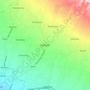
Name: Nglegok topographic map, elevation, terrain.
Location: Nglegok, Blitar, East Java, Java, 66181, Indonesia (-8.07500 112.17728 -7.99500 112.25728)
Average elevation: 1,086 ft
Minimum elevation: 696 ft
Maximum elevation: 1,837 ft
Thank you for supporting this site ❤️
Make a donation
Make a donation
Gear up for your next adventure:
As an Amazon Associate, this site earns from qualifying purchases at no extra cost to you.