Geolocate

Virginia topographic map

Click on the map to display elevation.

About this map

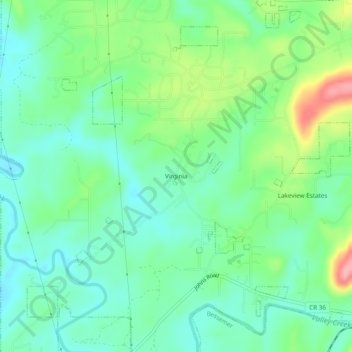
Name: Virginia topographic map, elevation, terrain.

Location: Virginia, Hueytown, Jefferson County, Alabama, United States (33.38900 -87.07055 33.42900 -87.03055)

Average elevation: 479 ft

Minimum elevation: 364 ft

Maximum elevation: 741 ft

Jefferson County trails, hiking, mountain biking, running and outdoor activities

Gear up for your next adventure:

🦶Carbon Trekking Poles - Reduce knee impact on steep descents with ultra-light poles
🗺️Topographic Maps - Detailed topo maps for hiking, exploring and outdoor navigation
🛰️Handheld GPS Units - Professional satellite navigators for precise backcountry mapping
🧤Hiking Gloves - Protective gloves for rugged trails
🪑Portable Camp Table - Compact table for campsite meals

As an Amazon Associate, this site earns from qualifying purchases at no extra cost to you.