
Thank you for supporting this site ❤️
Make a donation
Make a donation
Gear up for your next adventure:
As an Amazon Associate, this site earns from qualifying purchases at no extra cost to you.
Algona topographic map
Click on the map to display elevation.
Thank you for supporting this site ❤️
Make a donation
Make a donation
Gear up for your next adventure:
As an Amazon Associate, this site earns from qualifying purchases at no extra cost to you.
About this map
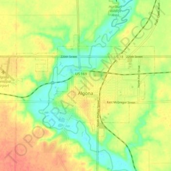
Name: Algona topographic map, elevation, terrain.
Location: Algona, Kossuth County, Iowa, 50511, United States (43.05469 -94.28195 43.09047 -94.19967)
Average elevation: 1,184 ft
Minimum elevation: 1,099 ft
Maximum elevation: 1,263 ft
Kossuth County trails, hiking, mountain biking, running and outdoor activities
Thank you for supporting this site ❤️
Make a donation
Make a donation
Gear up for your next adventure:
As an Amazon Associate, this site earns from qualifying purchases at no extra cost to you.