
Thank you for supporting this site ❤️
Make a donation
Make a donation
Gear up for your next adventure:
As an Amazon Associate, this site earns from qualifying purchases at no extra cost to you.
Appennino topographic map
Click on the map to display elevation.
Thank you for supporting this site ❤️
Make a donation
Make a donation
Gear up for your next adventure:
As an Amazon Associate, this site earns from qualifying purchases at no extra cost to you.
About this map
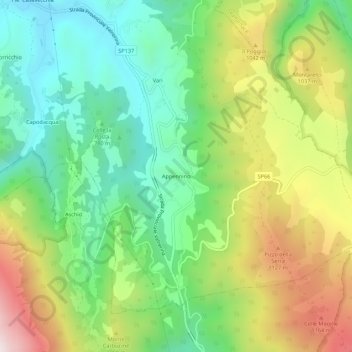
Name: Appennino topographic map, elevation, terrain.
Location: Appennino, Pieve Torina, Macerata, Marche, 62036, Italy (42.95780 13.05970 42.99780 13.09970)
Average elevation: 2,848 ft
Minimum elevation: 1,890 ft
Maximum elevation: 4,406 ft
Thank you for supporting this site ❤️
Make a donation
Make a donation
Gear up for your next adventure:
As an Amazon Associate, this site earns from qualifying purchases at no extra cost to you.