Geolocate

Beecher topographic map

Click on the map to display elevation.

About this map

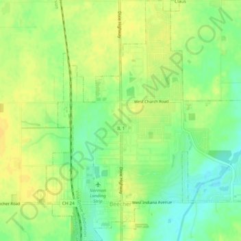
Name: Beecher topographic map, elevation, terrain.

Location: Beecher, Will County, Illinois, 60401, United States (41.33520 -87.63739 41.36987 -87.59730)

Average elevation: 735 ft

Minimum elevation: 689 ft

Maximum elevation: 764 ft

Will County trails, hiking, mountain biking, running and outdoor activities

Other topographic maps

Click on a map to view its topography, its elevation and its terrain.

Custer Park

United States > Illinois > Will County

Average elevation: 577 ft

Andres

United States > Illinois > Will County > Andres

Average elevation: 719 ft

Gear up for your next adventure:

📖Nature Tracking Books - Learn to track wildlife and terrain
🧼Biodegradable Camping Soap - Eco‑friendly soap for outdoor hygiene
📌Outdoor GPS Map App - Apps and devices for digital topographic navigation
🧦Merino Wool Socks - Moisture-wicking, blister-preventing socks for long treks
📷Action Cameras - Rugged cameras to document your journeys across rugged terrain

As an Amazon Associate, this site earns from qualifying purchases at no extra cost to you.