
Make a donation
Gear up for your next adventure:
As an Amazon Associate, this site earns from qualifying purchases at no extra cost to you.
Almaly District topographic map
Click on the map to display elevation.
Make a donation
Gear up for your next adventure:
As an Amazon Associate, this site earns from qualifying purchases at no extra cost to you.
About this map
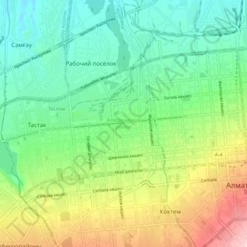
Name: Almaly District topographic map, elevation, terrain.
Location: Almaly District, Almaty, Kazakhstan (43.23315 76.86366 43.27041 76.94832)
Average elevation: 2,628 ft
Minimum elevation: 2,392 ft
Maximum elevation: 3,100 ft
Make a donation
Gear up for your next adventure:
As an Amazon Associate, this site earns from qualifying purchases at no extra cost to you.
Other topographic maps
Click on a map to view its topography, its elevation and its terrain.
Almaty
Almaty continues as the major commercial and cultural centre of Kazakhstan, as well as its most populous and most cosmopolitan city. The city is located in the mountainous area of southern Kazakhstan near the border with Kyrgyzstan in the foothills of the Trans-Ili Alatau at an elevation of 700–900 m…
Average elevation: 4,137 ft
Kok Tobe
Engineers chose the Köktöbe hill due to its high altitude (1130 meters above sea level, approximately 200 meters above the city). This elevation provided optimal coverage for the tower. The design was created in collaboration with the Moscow Institute of Central Research Institute of Cryogenics, and the…
Average elevation: 3,241 ft
Park named after the First President of the Republic of Kazakhstan
Average elevation: 3,346 ft