Geolocate

Mannheim topographic map

Click on the map to display elevation.

About this map

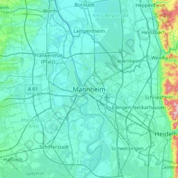
Name: Mannheim topographic map, elevation, terrain.

Location: Mannheim, Baden-Württemberg, 68161, Germany (49.32929 8.30731 49.64929 8.62731)

Average elevation: 377 ft

Minimum elevation: 272 ft

Maximum elevation: 1,621 ft

Gear up for your next adventure:

Backpacking Tents - Weight-optimized shelters for multi-day topographic surveys
📱Solar Portable Charger - Solar power bank for charging devices off‑grid
Solar GPS Watches - Advanced multisport watches with built-in topographic maps
🦺Reflective Outdoor Gear - Safety gear for low‑light conditions
📻Weather Alert Radios - Stay informed of storm risks while off-the-grid

As an Amazon Associate, this site earns from qualifying purchases at no extra cost to you.