Geolocate

Islampur topographic map

Click on the map to display elevation.

About this map

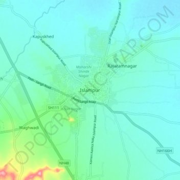
Name: Islampur topographic map, elevation, terrain.

Location: Islampur, Walwa, Sangli District, Maharashtra, 415409, India (17.01022 74.22617 17.09022 74.30617)

Average elevation: 1,913 ft

Minimum elevation: 1,821 ft

Maximum elevation: 2,395 ft

Other topographic maps

Click on a map to view its topography, its elevation and its terrain.

Walwa

India > Maharashtra > Walwa

Average elevation: 1,932 ft

Gear up for your next adventure:

🔌Solar Panel Charger - Charge gear sustainably outdoors
🛏️Cold Weather Sleeping Bag - Warm sleeping bag for cold conditions
👖Convertible Hiking Pants - Versatile zip-off pants for changing altitudes and temperatures
🏔️Mountain Trail Maps - High‑detail maps for popular peaks
🌡️Portable Weather Meter - Track weather conditions on the trail

As an Amazon Associate, this site earns from qualifying purchases at no extra cost to you.