
Monto topographic map
Click on the map to display elevation.
About this map
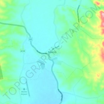
Name: Monto topographic map, elevation, terrain.
Location: Monto, Queensland, Australia (-24.90393 151.08236 -24.82393 151.16236)
Average elevation: 846 ft
Minimum elevation: 722 ft
Maximum elevation: 1,385 ft
Other topographic maps
Click on a map to view its topography, its elevation and its terrain.