
Thank you for supporting this site ❤️
Make a donation
Make a donation
Gear up for your next adventure:
As an Amazon Associate, this site earns from qualifying purchases at no extra cost to you.
Kondakavuru topographic map
Click on the map to display elevation.
Thank you for supporting this site ❤️
Make a donation
Make a donation
Gear up for your next adventure:
As an Amazon Associate, this site earns from qualifying purchases at no extra cost to you.
About this map
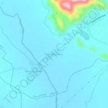
Name: Kondakavuru topographic map, elevation, terrain.
Location: Kondakavuru, Narasaraopet, Palnadu, Andhra Pradesh, India (16.11154 80.00713 16.15154 80.04713)
Average elevation: 249 ft
Minimum elevation: 148 ft
Maximum elevation: 1,322 ft
Thank you for supporting this site ❤️
Make a donation
Make a donation
Gear up for your next adventure:
As an Amazon Associate, this site earns from qualifying purchases at no extra cost to you.