
Thank you for supporting this site ❤️
Make a donation
Make a donation
Gear up for your next adventure:
As an Amazon Associate, this site earns from qualifying purchases at no extra cost to you.
Muruhuay topographic map
Click on the map to display elevation.
Thank you for supporting this site ❤️
Make a donation
Make a donation
Gear up for your next adventure:
As an Amazon Associate, this site earns from qualifying purchases at no extra cost to you.
About this map
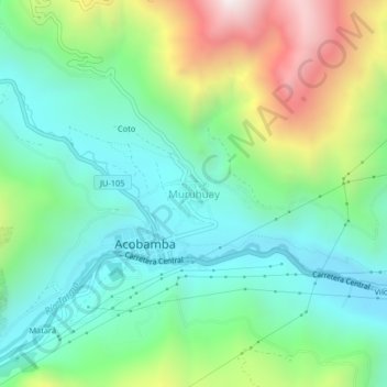
Name: Muruhuay topographic map, elevation, terrain.
Location: Muruhuay, Acobamba, Tarma, Junín, Perú (-11.36737 -75.67421 -11.32737 -75.63421)
Average elevation: 10,738 ft
Minimum elevation: 9,518 ft
Maximum elevation: 13,510 ft
Thank you for supporting this site ❤️
Make a donation
Make a donation
Gear up for your next adventure:
As an Amazon Associate, this site earns from qualifying purchases at no extra cost to you.