Geolocate

Trier topographic map

Click on the map to display elevation.

About this map

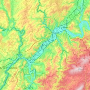
Name: Trier topographic map, elevation, terrain.

Location: Trier, Rhineland-Palatinate, 54290, Germany (49.59962 6.48419 49.91962 6.80419)

Average elevation: 1,030 ft

Minimum elevation: 367 ft

Maximum elevation: 2,336 ft

Gear up for your next adventure:

🏕️Tent Footprint - Protect your tent base from wear
🧭Compass with Lanyard - Easy‑carry compass for navigation
🧼Biodegradable Camping Soap - Eco‑friendly soap for outdoor hygiene
🔪Outdoor Multitools - Essential survival tools for gear repair and field use
📻Weather Alert Radios - Stay informed of storm risks while off-the-grid

As an Amazon Associate, this site earns from qualifying purchases at no extra cost to you.