
Thank you for supporting this site ❤️
Make a donation
Make a donation
Gear up for your next adventure:
As an Amazon Associate, this site earns from qualifying purchases at no extra cost to you.
Itzgrund topographic map
Click on the map to display elevation.
Thank you for supporting this site ❤️
Make a donation
Make a donation
Gear up for your next adventure:
As an Amazon Associate, this site earns from qualifying purchases at no extra cost to you.
About this map
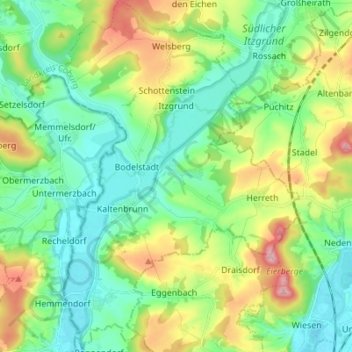
Name: Itzgrund topographic map, elevation, terrain.
Location: Itzgrund, Landkreis Coburg, Bayern, 96274, Deutschland (50.08824 10.84906 50.17636 10.94855)
Average elevation: 1,007 ft
Minimum elevation: 817 ft
Maximum elevation: 1,434 ft
Thank you for supporting this site ❤️
Make a donation
Make a donation
Gear up for your next adventure:
As an Amazon Associate, this site earns from qualifying purchases at no extra cost to you.