
Make a donation
Gear up for your next adventure:
As an Amazon Associate, this site earns from qualifying purchases at no extra cost to you.
Val Louron topographic map
Click on the map to display elevation.
Make a donation
Gear up for your next adventure:
As an Amazon Associate, this site earns from qualifying purchases at no extra cost to you.
Val Louron
Val-Louron se situe plus précisément dans le Pays d'Aure en vallée du Louron au sud-est de Bagnères-de-Bigorre en Bigorre. Son altitude est comprise entre 1 450 m au bas de la station et 2 100 m au sommet. C'est une station à vocation familiale.
Make a donation
Gear up for your next adventure:
As an Amazon Associate, this site earns from qualifying purchases at no extra cost to you.
About this map
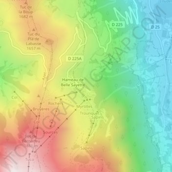
Name: Val Louron topographic map, elevation, terrain.
Average elevation: 4,606 ft
Minimum elevation: 3,117 ft
Maximum elevation: 6,572 ft
Make a donation
Gear up for your next adventure:
As an Amazon Associate, this site earns from qualifying purchases at no extra cost to you.
Other topographic maps
Click on a map to view its topography, its elevation and its terrain.