Geolocate

Grassland Addition topographic map

Click on the map to display elevation.

About this map
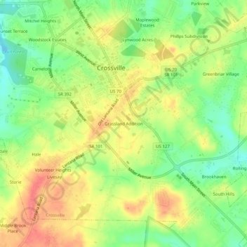
Name: Grassland Addition topographic map, elevation, terrain.

Location: Grassland Addition, Crossville, Cumberland County, East Tennessee, Tennessee, 38555, United States (35.92062 -85.04496 35.96062 -85.00496)

Average elevation: 1,837 ft

Minimum elevation: 1,726 ft

Maximum elevation: 1,942 ft

Cumberland County trails, hiking, mountain biking, running and outdoor activities

Other topographic maps

Click on a map to view its topography, its elevation and its terrain.
Gear up for your next adventure:

🌎3D Topographic Globes - Raised relief globes for a tactile understanding of geography
🔥Camping Stove - Portable stove for camping and backcountry cooking
🛠️Outdoor Gear Repair Kit - Essential tools to fix gear on the trail
👖Convertible Hiking Pants - Versatile zip-off pants for changing altitudes and temperatures
⌚GPS Sports Watch - GPS watch for running, hiking and training

As an Amazon Associate, this site earns from qualifying purchases at no extra cost to you.