
Thank you for supporting this site ❤️
Make a donation
Make a donation
Gear up for your next adventure:
As an Amazon Associate, this site earns from qualifying purchases at no extra cost to you.
Barratera topographic map
Click on the map to display elevation.
Thank you for supporting this site ❤️
Make a donation
Make a donation
Gear up for your next adventure:
As an Amazon Associate, this site earns from qualifying purchases at no extra cost to you.
About this map
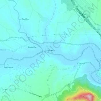
Name: Barratera topographic map, elevation, terrain.
Location: Barratera, Cieza, Vega Alta del Segura, Murcia, 30530, Spanje (38.22557 -1.47297 38.26557 -1.43297)
Average elevation: 699 ft
Minimum elevation: 538 ft
Maximum elevation: 1,890 ft
Thank you for supporting this site ❤️
Make a donation
Make a donation
Gear up for your next adventure:
As an Amazon Associate, this site earns from qualifying purchases at no extra cost to you.