
Thank you for supporting this site ❤️
Make a donation
Make a donation
Gear up for your next adventure:
As an Amazon Associate, this site earns from qualifying purchases at no extra cost to you.
Pedrissa topographic map
Click on the map to display elevation.
Thank you for supporting this site ❤️
Make a donation
Make a donation
Gear up for your next adventure:
As an Amazon Associate, this site earns from qualifying purchases at no extra cost to you.
About this map
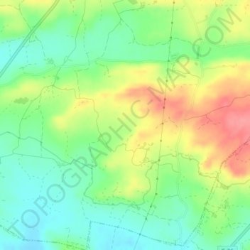
Name: Pedrissa topographic map, elevation, terrain.
Location: Pedrissa, Camarasa, Noguera, Lérida, Cataluña, 25613, España (41.82107 0.86436 41.84107 0.88436)
Average elevation: 958 ft
Minimum elevation: 846 ft
Maximum elevation: 1,115 ft
Thank you for supporting this site ❤️
Make a donation
Make a donation
Gear up for your next adventure:
As an Amazon Associate, this site earns from qualifying purchases at no extra cost to you.