
Thank you for supporting this site ❤️
Make a donation
Make a donation
Gear up for your next adventure:
As an Amazon Associate, this site earns from qualifying purchases at no extra cost to you.
Uddusò/Buddusò topographic map
Click on the map to display elevation.
Thank you for supporting this site ❤️
Make a donation
Make a donation
Gear up for your next adventure:
As an Amazon Associate, this site earns from qualifying purchases at no extra cost to you.
About this map
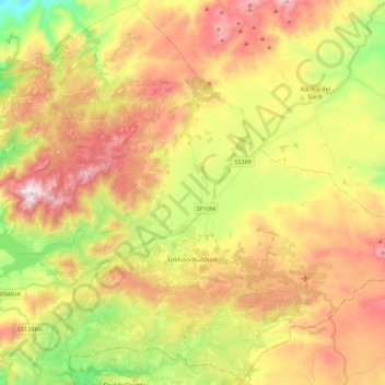
Name: Uddusò/Buddusò topographic map, elevation, terrain.
Location: Uddusò/Buddusò, Sassari, Sardinia, Italy (40.52583 9.17534 40.68802 9.39418)
Average elevation: 2,310 ft
Minimum elevation: 1,066 ft
Maximum elevation: 3,550 ft
Thank you for supporting this site ❤️
Make a donation
Make a donation
Gear up for your next adventure:
As an Amazon Associate, this site earns from qualifying purchases at no extra cost to you.
Other topographic maps
Click on a map to view its topography, its elevation and its terrain.