Geolocate

Sassari topographic map

Click on the map to display elevation.

About this map

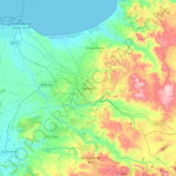
Name: Sassari topographic map, elevation, terrain.

Location: Sassari, Sardinia, 07100, Italy (40.56326 8.40101 40.88326 8.72101)

Average elevation: 673 ft

Minimum elevation: 0 ft

Maximum elevation: 2,438 ft

Gear up for your next adventure:

🪶Camp Gear Gift Set - Perfect gift bundle for outdoor fans
🗺️NatGeo Topo Maps - High-quality waterproof printed topographic maps of US Parks
🔥Fast-Boil Camping Stoves - Efficient cooking systems for quick trail meals
🔥Camping Stove - Portable stove for camping and backcountry cooking
🥩Freeze-Dried Meals - Nutritious and lightweight food for remote expeditions

As an Amazon Associate, this site earns from qualifying purchases at no extra cost to you.