
Tarseh Bolagh topographic map
Interactive map
Click on the map to display elevation.
About this map
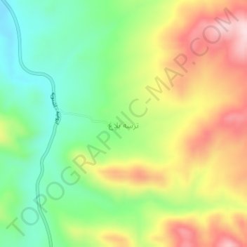
Name: Tarseh Bolagh topographic map, elevation, terrain.
Average elevation: 5,873 ft
Minimum elevation: 5,449 ft
Maximum elevation: 6,414 ft
Other topographic maps
Click on a map to view its topography, its elevation and its terrain.
Oshnavieh County
Iran > West Azerbaijan Province > Oshnavieh County
Oshnavieh County, West Azerbaijan Province, Iran
Average elevation: 6,476 ft