
Oshnavieh County topographic map
Interactive map
Click on the map to display elevation.
About this map
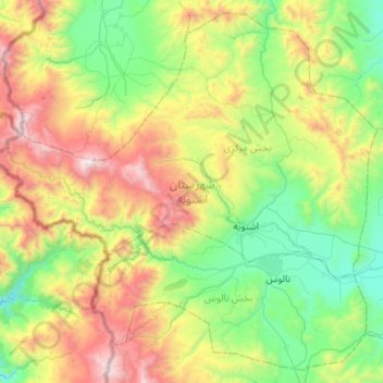
Name: Oshnavieh County topographic map, elevation, terrain.
Location: Oshnavieh County, West Azerbaijan Province, Iran (36.88086 44.74760 37.27952 45.28270)
Average elevation: 6,476 ft
Minimum elevation: 4,150 ft
Maximum elevation: 11,427 ft
Other topographic maps
Click on a map to view its topography, its elevation and its terrain.
Tarseh Bolagh
Iran > West Azerbaijan Province > Oshnavieh County
Tarseh Bolagh, بخش مرکزی, Oshnavieh County, West Azerbaijan Province, Iran
Average elevation: 5,873 ft