Geolocate

Boss topographic map

Click on the map to display elevation.

About this map

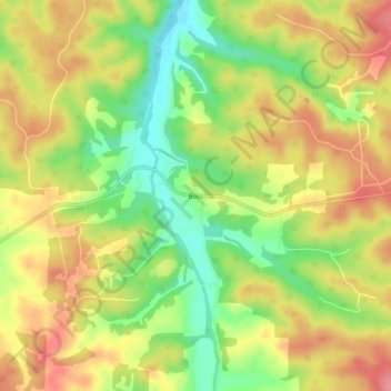
Name: Boss topographic map, elevation, terrain.

Location: Boss, Dent County, Missouri, 65440, United States (37.62310 -91.20930 37.66310 -91.16930)

Average elevation: 1,152 ft

Minimum elevation: 981 ft

Maximum elevation: 1,306 ft

Dent County trails, hiking, mountain biking, running and outdoor activities

Gear up for your next adventure:

🚑Emergency Bivvies - Heat-reflective sleeping bags for survival situations
📚Navigation Handbooks - Master the art of reading topographic maps and using a compass
🦺Reflective Outdoor Gear - Safety gear for low‑light conditions
🏫Relief Map Kits - Hands-on tools for teaching landforms and elevation
🔋Solar Power Banks - Keep your GPS and phone charged in remote wilderness areas

As an Amazon Associate, this site earns from qualifying purchases at no extra cost to you.