
Thank you for supporting this site ❤️
Make a donation
Make a donation
Gear up for your next adventure:
As an Amazon Associate, this site earns from qualifying purchases at no extra cost to you.
Ram Shahr topographic map
Click on the map to display elevation.
Thank you for supporting this site ❤️
Make a donation
Make a donation
Gear up for your next adventure:
As an Amazon Associate, this site earns from qualifying purchases at no extra cost to you.
About this map
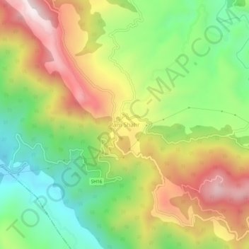
Name: Ram Shahr topographic map, elevation, terrain.
Location: Ram Shahr, Ramshahr, Solan, Himachal Pradesh, India (31.06907 76.77619 31.10907 76.81619)
Average elevation: 2,667 ft
Minimum elevation: 1,588 ft
Maximum elevation: 3,970 ft
Thank you for supporting this site ❤️
Make a donation
Make a donation
Gear up for your next adventure:
As an Amazon Associate, this site earns from qualifying purchases at no extra cost to you.