Geolocate

Lake May topographic map

Click on the map to display elevation.

About this map

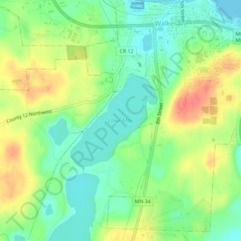
Name: Lake May topographic map, elevation, terrain.

Location: Lake May, Walker, Cass County, Minnesota, United States (47.08561 -94.60076 47.09601 -94.58638)

Average elevation: 1,375 ft

Minimum elevation: 1,293 ft

Maximum elevation: 1,490 ft

Cass County trails, hiking, mountain biking, running and outdoor activities

Gear up for your next adventure:

🗃️Trail First Aid Kit - Essential kit for outdoor injuries and emergencies
🔦LED Headlamp - Bright and durable LED headlamp for night navigation
🧭Outdoor Navigation Book - Learn advanced navigation skills
🥤Water Filter Bottle - All‑in‑one filter bottle for safe hydration
📦Gear Storage Bags - Organize and protect outdoor equipment

As an Amazon Associate, this site earns from qualifying purchases at no extra cost to you.