
Klingenburg topographic map
Interactive map
Click on the map to display elevation.
About this map
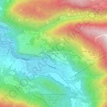
Name: Klingenburg topographic map, elevation, terrain.
Location: Klingenburg, Oetz, Bezirk Imst, 6433, Oostenrijk (47.18917 10.87399 47.22917 10.91399)
Average elevation: 3,812 ft
Minimum elevation: 2,408 ft
Maximum elevation: 6,125 ft
Other topographic maps
Click on a map to view its topography, its elevation and its terrain.
Mühlau
Oostenrijk > Bezirk Imst > Oetz
Mühlau, Oetz, Bezirk Imst, 6433, Oostenrijk
Average elevation: 3,612 ft