Geolocate

Holy Cross topographic map

Click on the map to display elevation.

About this map

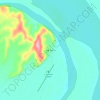
Name: Holy Cross topographic map, elevation, terrain.

Location: Holy Cross, Unorganized Borough, Alaska, United States (62.17944 -159.79139 62.21944 -159.75139)

Average elevation: 108 ft

Minimum elevation: 13 ft

Maximum elevation: 538 ft

Unorganized Borough trails, hiking, mountain biking, running and outdoor activities

Gear up for your next adventure:

GPS Sports Watch - GPS watch for running, hiking and training
🌲Outdoor Survival Books - Best books on survival skills
🔭Telescopic Hiking Pole - Adjustable pole for hiking stability
📖Nature Tracking Books - Learn to track wildlife and terrain
📚USA Hiking Guide Books - Top trail guides and map books

As an Amazon Associate, this site earns from qualifying purchases at no extra cost to you.