
Gardabani topographic map
Click on the map to display elevation.
Gardabani
Gardabani (Georgian: გარდაბანი) is a city of 11,650 residents (2021) in the southern Georgian region of Kvemo Kartli and is the administrative centre of the Gardabani Municipality. It is located 34 kilometres (21 mi) southeast of capital Tbilisi and 10 kilometres (6.2 mi) from Rustavi in the Kvemo Kartli Plain at an elevation of 300 metres (980 ft) above sea level. Until 1947 Gardabani was known as Karayazi (Azerbaijani: Qarayazı) and the city status was granted in 1969, after a thermal power plant was built for Tbilisi in the 1960s causing rapid growth. Since then more plower plants have been built and the city nowadays supplies almost all thermally generated electricity in the country.
About this map
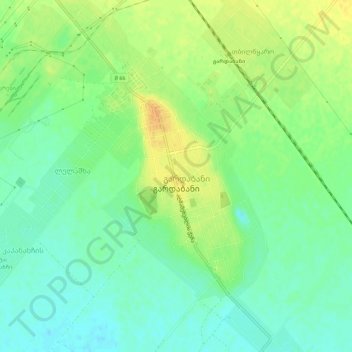
Name: Gardabani topographic map, elevation, terrain.
Location: Gardabani, Gardabani Municipality, Lower Kartli, 1300, Georgia (41.44032 45.07181 41.48171 45.10517)
Average elevation: 981 ft
Minimum elevation: 938 ft
Maximum elevation: 1,033 ft
Other topographic maps
Click on a map to view its topography, its elevation and its terrain.
Gardabani
Georgia > Lower Kartli > Gardabani Municipality
Gardabani (Georgian: გარდაბანი) is a city of 11,650 residents (2021) in the valley or plain of the same name, in the southern Georgian region of Kvemo Kartli and is the administrative centre of the Gardabani Municipality. It is located 34 kilometres (21 mi) southeast of capital Tbilisi and 10…
Average elevation: 981 ft