Geolocate

Mukhiguda topographic map

Click on the map to display elevation.

About this map

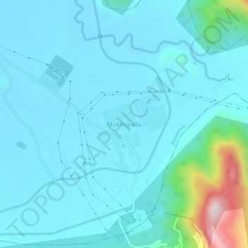
Name: Mukhiguda topographic map, elevation, terrain.

Location: Mukhiguda, Jayapatna, Kalahandi District, Odisha, India (19.42105 82.83315 19.46105 82.87315)

Average elevation: 1,010 ft

Minimum elevation: 797 ft

Maximum elevation: 2,549 ft

Gear up for your next adventure:

🥘Titanium Cookware - Durable, featherlight pots and pans for backpacking
🪓Survival Multi‑Tool - Versatile tool for camp and trail tasks
🔦Compact Flashlight - Reliable flashlight for emergencies
🧦Hiking Socks - Comfortable socks to prevent blisters on long hikes
🧣Merino Neck Gaiters - Multi-functional headwear for wind and sun protection

As an Amazon Associate, this site earns from qualifying purchases at no extra cost to you.