Geolocate

Kibanban topographic map

Click on the map to display elevation.

About this map

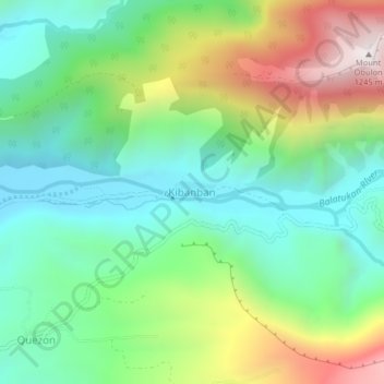
Name: Kibanban topographic map, elevation, terrain.

Location: Kibanban, Misamis Oriental, Northern Mindanao, Philippines (8.76560 124.82424 8.80560 124.86424)

Average elevation: 1,588 ft

Minimum elevation: 335 ft

Maximum elevation: 4,088 ft

Other topographic maps

Click on a map to view its topography, its elevation and its terrain.

Gingoog

Philippines > Misamis Oriental

Average elevation: 1,470 ft

Gear up for your next adventure:

🧼Biodegradable Camping Soap - Eco‑friendly soap for outdoor hygiene
🪶Compact Camp Shovel - Folding shovel for campsite tasks
🪑Portable Camp Table - Compact table for campsite meals
🌎3D Topographic Globes - Raised relief globes for a tactile understanding of geography
🧭Outdoor Navigation Book - Learn advanced navigation skills

As an Amazon Associate, this site earns from qualifying purchases at no extra cost to you.