
Garoowe topographic map
Click on the map to display elevation.
Garoowe
Garowe is situated in the Nugaal Valley, bounded by gradually ascending high plateaus that generally reach elevations of 500 to 1,000 metres (1,600 to 3,300 feet) above sea level on the north, west, and south. The western part of the same plateau is crossed by numerous valleys and dry watercourses. Raising livestock forms the basis of the economy, and frankincense and myrrh are collected from the wild trees.
About this map
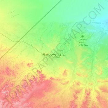
Name: Garoowe topographic map, elevation, terrain.
Location: Garoowe, Garowe District, Nugaal, Puntland, Somalia (8.24614 48.32320 8.56614 48.64320)
Average elevation: 1,594 ft
Minimum elevation: 1,296 ft
Maximum elevation: 2,116 ft