Geolocate

Cave Spring topographic map

Click on the map to display elevation.

About this map

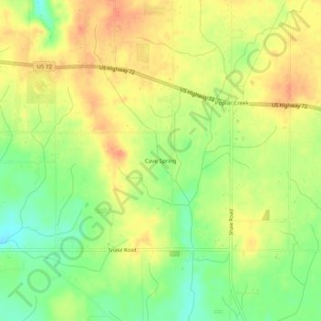
Name: Cave Spring topographic map, elevation, terrain.

Location: Cave Spring, Limestone County, Alabama, United States (34.76842 -87.15557 34.80842 -87.11557)

Average elevation: 682 ft

Minimum elevation: 597 ft

Maximum elevation: 745 ft

Other topographic maps

Click on a map to view its topography, its elevation and its terrain.

Elkmont

United States > Alabama > Limestone County

Average elevation: 817 ft

Athens

United States > Alabama > Limestone County

Average elevation: 669 ft

Elkmont

United States > Alabama > Limestone County

Average elevation: 817 ft

Athens

United States > Alabama > Limestone County

Average elevation: 669 ft

Gear up for your next adventure:

🥾Men's Hiking Boots - Durable, waterproof footwear for rugged terrain and steep inclines
🔊Portable Camp Speaker - Music and alerts at camp
🛠️Outdoor Gear Repair Kit - Essential tools to fix gear on the trail
🪶Trail Camera - Capture wildlife on your hikes
🥩Freeze-Dried Meals - Nutritious and lightweight food for remote expeditions

As an Amazon Associate, this site earns from qualifying purchases at no extra cost to you.