
Thank you for supporting this site ❤️
Make a donation
Make a donation
Gear up for your next adventure:
As an Amazon Associate, this site earns from qualifying purchases at no extra cost to you.
Cortegada topographic map
Click on the map to display elevation.
Thank you for supporting this site ❤️
Make a donation
Make a donation
Gear up for your next adventure:
As an Amazon Associate, this site earns from qualifying purchases at no extra cost to you.
About this map
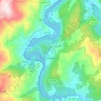
Name: Cortegada topographic map, elevation, terrain.
Location: Cortegada, O Ribeiro, Ourense, Galice, Espagne (42.17926 -8.19226 42.24513 -8.11529)
Average elevation: 906 ft
Minimum elevation: 213 ft
Maximum elevation: 2,605 ft
Thank you for supporting this site ❤️
Make a donation
Make a donation
Gear up for your next adventure:
As an Amazon Associate, this site earns from qualifying purchases at no extra cost to you.