
Thank you for supporting this site ❤️
Make a donation
Make a donation
Gear up for your next adventure:
As an Amazon Associate, this site earns from qualifying purchases at no extra cost to you.
Irishtown topographic map
Click on the map to display elevation.
Thank you for supporting this site ❤️
Make a donation
Make a donation
Gear up for your next adventure:
As an Amazon Associate, this site earns from qualifying purchases at no extra cost to you.
About this map
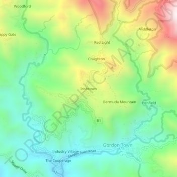
Name: Irishtown topographic map, elevation, terrain.
Location: Irishtown, Gordon Town, Saint Andrew, Surrey County, Jamaica (18.02917 -76.74590 18.06917 -76.70590)
Average elevation: 2,011 ft
Minimum elevation: 863 ft
Maximum elevation: 4,101 ft
Thank you for supporting this site ❤️
Make a donation
Make a donation
Gear up for your next adventure:
As an Amazon Associate, this site earns from qualifying purchases at no extra cost to you.