Geolocate

Giingee topographic map

Click on the map to display elevation.

Giingee

Gingee is located at 12°15′N 79°25′E / 12.25°N 79.42°E / 12.25; 79.42. It has an average elevation of 92 metres (301 ft).

Wikipedia (CC-BY-SA 3.0)

About this map

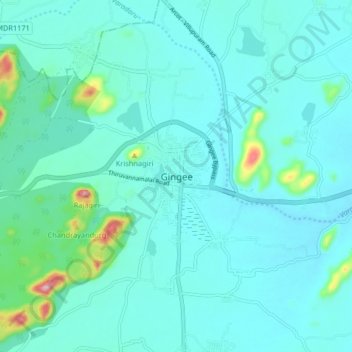
Name: Giingee topographic map, elevation, terrain.

Location: Giingee, Gingee, Viluppuram, Tamil Nadu, 604202, India (12.21442 79.37578 12.29442 79.45578)

Average elevation: 335 ft

Minimum elevation: 236 ft

Maximum elevation: 988 ft

Gear up for your next adventure:

Solar GPS Watches - Advanced multisport watches with built-in topographic maps
🥾Women's Hiking Boots - Top-rated trail boots with ankle support and superior grip
🔦Powerful Headlamps - Ultra-bright hands-free lighting for night navigation
🌡️Portable Weather Meter - Track weather conditions on the trail
🪄Magnetic Compass - Accurate compass for navigation

As an Amazon Associate, this site earns from qualifying purchases at no extra cost to you.