Geolocate

Kankakee topographic map

Click on the map to display elevation.

About this map

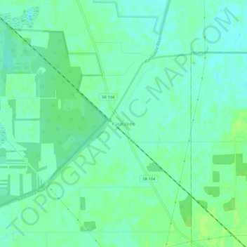
Name: Kankakee topographic map, elevation, terrain.

Location: Kankakee, LaPorte County, Indiana, United States (41.48838 -86.55946 41.52838 -86.51946)

Average elevation: 689 ft

Minimum elevation: 673 ft

Maximum elevation: 705 ft

LaPorte County trails, hiking, mountain biking, running and outdoor activities

Other topographic maps

Click on a map to view its topography, its elevation and its terrain.

Wanatah

United States > Indiana > LaPorte County

Average elevation: 732 ft

Kingsford Heights

United States > Indiana > LaPorte County

Average elevation: 715 ft

La Crosse

United States > Indiana > LaPorte County

Average elevation: 676 ft

Michiana Shores

United States > Indiana > LaPorte County

Average elevation: 614 ft

Galena River

United States > Indiana > LaPorte County

Average elevation: 719 ft

Trail Creek

United States > Indiana > LaPorte County

Average elevation: 636 ft

Fish Creek

United States > Indiana > LaPorte County

Average elevation: 712 ft

Gear up for your next adventure:

🪶Trail Camera - Capture wildlife on your hikes
📷Action Camera - Capture your outdoor adventures in HD
💧Water Purification System - Clean water on the trail with reliable purifiers
💧Water Filtration Bottles - Safely drink from streams and lakes while exploring
🔦Powerful Headlamps - Ultra-bright hands-free lighting for night navigation

As an Amazon Associate, this site earns from qualifying purchases at no extra cost to you.