
Thank you for supporting this site ❤️
Make a donation
Make a donation
Gear up for your next adventure:
As an Amazon Associate, this site earns from qualifying purchases at no extra cost to you.
Gonja topographic map
Click on the map to display elevation.
Thank you for supporting this site ❤️
Make a donation
Make a donation
Gear up for your next adventure:
As an Amazon Associate, this site earns from qualifying purchases at no extra cost to you.
About this map
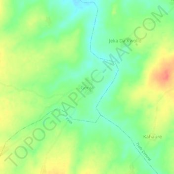
Name: Gonja topographic map, elevation, terrain.
Location: Gonja, Kwaren Ganuwa, Tsafe, Zamfara State, Nigeria (11.85781 6.81862 11.89781 6.85862)
Average elevation: 1,762 ft
Minimum elevation: 1,686 ft
Maximum elevation: 1,857 ft
Thank you for supporting this site ❤️
Make a donation
Make a donation
Gear up for your next adventure:
As an Amazon Associate, this site earns from qualifying purchases at no extra cost to you.