
Make a donation
Gear up for your next adventure:
As an Amazon Associate, this site earns from qualifying purchases at no extra cost to you.
Kashmir Valley topographic map
Click on the map to display elevation.
Make a donation
Gear up for your next adventure:
As an Amazon Associate, this site earns from qualifying purchases at no extra cost to you.
Kashmir Valley
The Kashmir Valley lies between latitude 33° and 35°N, and longitude 73° and 76°E. The valley is 100 km (62 mi) wide and covers 15,520.3 km2 (5,992.4 sq mi) in area. It is bounded by sub-ranges of the Western Himalayas: the Great Himalayas bound it in the northeast and separate it from the Tibetan Plateau, whereas the Pir Panjal Range in the Lesser Himalayas bounds it on the west and the south, and separates it from the Punjab Plain. The valley has an average elevation of 1,850 metres (6,070 ft) above sea-level, but the surrounding Pir Panjal range has an average elevation of 10,000 feet (3,000 m). The Jhelum River is the main river of the Valley. It originates at Verinag; its most important tributaries are the Lidder and Sind rivers. Unlike other areas of Kashmir region, the Kashmir Valley is densely populated owing to the availability of a large expanse of fertile flat land.
Make a donation
Gear up for your next adventure:
As an Amazon Associate, this site earns from qualifying purchases at no extra cost to you.
About this map
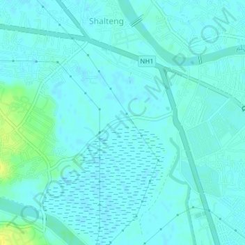
Name: Kashmir Valley topographic map, elevation, terrain.
Average elevation: 5,200 ft
Minimum elevation: 5,187 ft
Maximum elevation: 5,246 ft
Make a donation
Gear up for your next adventure:
As an Amazon Associate, this site earns from qualifying purchases at no extra cost to you.