Geolocate

Anzac topographic map

Click on the map to display elevation.

About this map

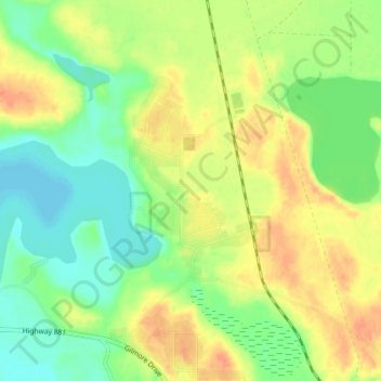
Name: Anzac topographic map, elevation, terrain.

Location: Anzac, Division No. 16, Alberta, T0P 1J0, Canada (56.43259 -111.06824 56.47259 -111.02824)

Average elevation: 1,611 ft

Minimum elevation: 1,545 ft

Maximum elevation: 1,683 ft

Gear up for your next adventure:

🥤Water Filter Bottle - All‑in‑one filter bottle for safe hydration
🪑Portable Camp Table - Compact table for campsite meals
🌡️Handheld Weather Meters - Measure wind, temp, and pressure for safe mountain travel
🌄Hiking Binoculars - Compact binoculars for scenic views and trail spotting
🗃️Trail First Aid Kit - Essential kit for outdoor injuries and emergencies

As an Amazon Associate, this site earns from qualifying purchases at no extra cost to you.