
Thank you for supporting this site ❤️
Make a donation
Make a donation
Gear up for your next adventure:
As an Amazon Associate, this site earns from qualifying purchases at no extra cost to you.
Zacualtipán topographic map
Click on the map to display elevation.
Thank you for supporting this site ❤️
Make a donation
Make a donation
Gear up for your next adventure:
As an Amazon Associate, this site earns from qualifying purchases at no extra cost to you.
About this map
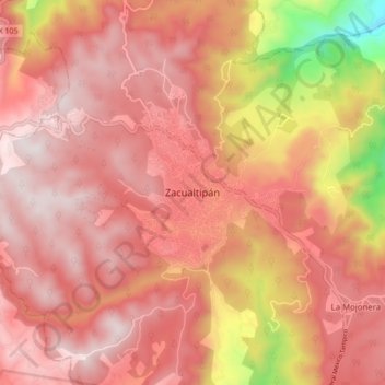
Name: Zacualtipán topographic map, elevation, terrain.
Location: Zacualtipán, Zacualtipán de Ángeles, Hidalgo, 43200, Mexico (20.60979 -98.69633 20.68979 -98.61633)
Average elevation: 6,342 ft
Minimum elevation: 4,111 ft
Maximum elevation: 7,326 ft
Thank you for supporting this site ❤️
Make a donation
Make a donation
Gear up for your next adventure:
As an Amazon Associate, this site earns from qualifying purchases at no extra cost to you.